Vol. 1 Summation - Central Monaro Plains Deep Landscape Values Assessment

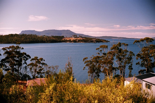
The Brothers on the Central Monaro Plains (Photo by Dr. Dennis Williamson © 2024)

BY DR. DENNIS WILLIAMSON

Copyright © 2025 by Dennis N. Williamson and Geoscene International (a division of Scenic Spectrums Pty Ltd). All rights reserved.

During 2024-25, the Central Monaro Plains Deep Landscape Values Assessment was prepared by Geoscene International on behalf of a Cooma, New South Wales region community group - Rural Landscape Monaro Inc.

This research study of the Central Monaro Plains (CMP) has created quite a journey, not measured simply in kilometers or hectares, but also in people met or read about and in the great knowledge gained regarding the landscape values of this South East New South Wales region. It is for good reason that this project is called the Central Monaro Plains Deep Landscape Values Assessment.

The Central Monaro Plains (CMP) region covers over 336,000 ha of land located about 90 km South of the Australian capital city of Canberra, ACT). It stretches 75 km or so east to west from the Great Escarpment across the Kybeyan Range and the Great Divide (Monaro Range) to near Varney’s Range just west of Berridale. It extends and nearly 70 km from the Chakola vicinity north of Cooma southward over the Great Divide before reaching the Maclaughlin River and the Snowy River Way.

This project is what we call a ‘deep landscape values assessment’ (DLVA). The primary focus is the rural and natural landscapes of the central Monaro region. The landscape values of the regional townships and urban areas of Cooma, Berridale, Numeralla, and Nimmitabel are not addressed. An extensive amount of information has been documented, identifying multiple environmental, ecological, tourism, scenic, and cultural heritage (Aboriginal and Non-Aboriginal) attributes of varying landscape value. Some of the highlights of these findings and mapped information are provided in the Vol. 1 Summation section of the report.

The CMP project does not address the commercial or economic values of mineral, forest or agricultural resources, etc. Those types of land uses and values are already considered by the NSW statutory and strategic land planning system through various regional strategies, Local Environment Plans (LEPs) and various government and Independent Planning Commission reviews of major project proposals. Specific proposed land developments are not addressed in this report. Existing landscape alterations are assessed generally in terms of their positive or negative effects on existing scenic quality. Broad biodiversity and landscape management recommendations that mention selected types of land use or landscape alterations are also provided.

What has been learned about this region now fills six volumes of the entire report. Each volume is a stand-alone document but is interdependent on the other volumes. Volume 1: Summation presents a brief overview and highlights of our learnings. Some of the key things we have rediscovered include:

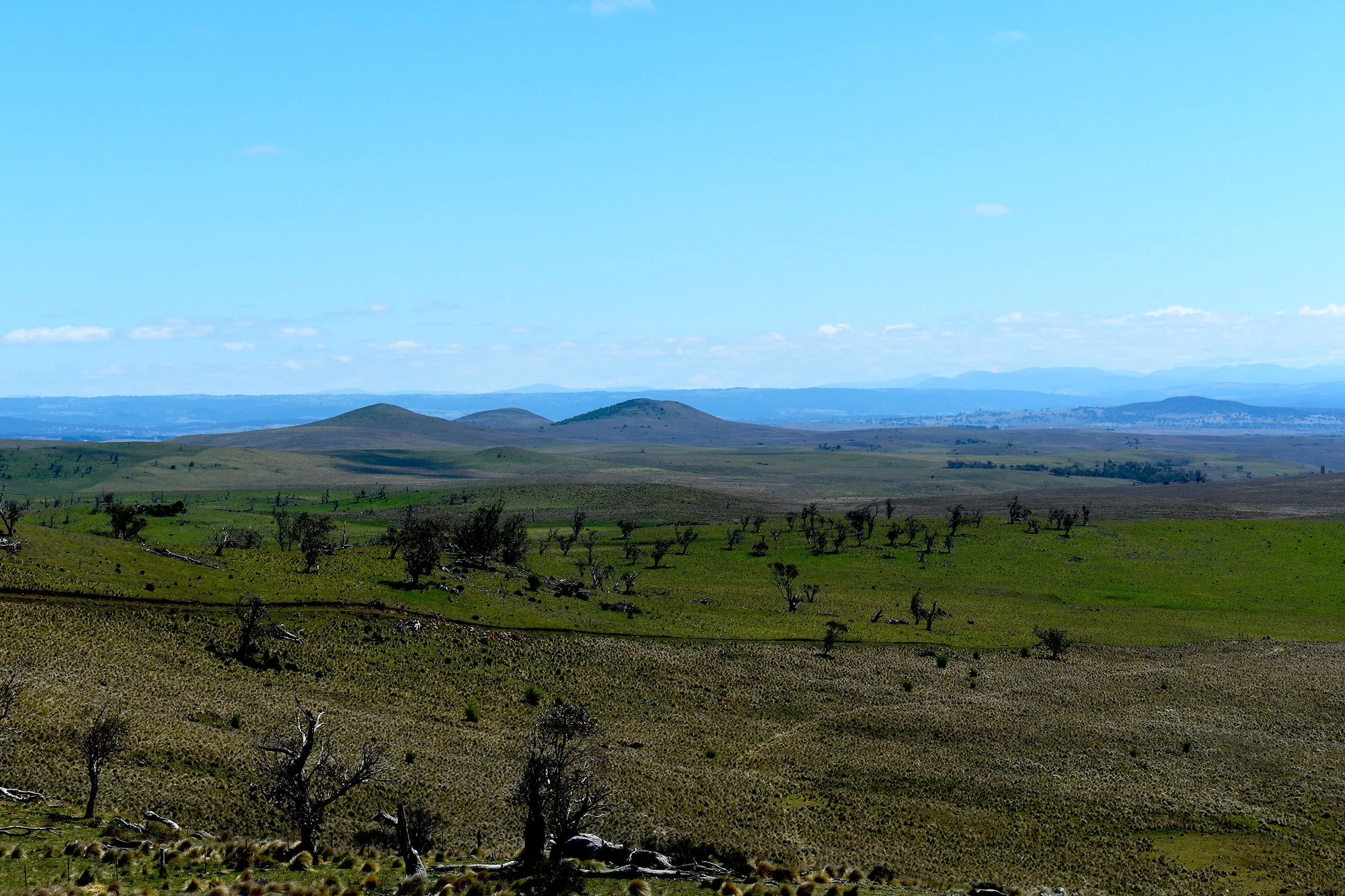
1. The Monaro Volcanic Province (MVP) is a 4,200 km2 area of regional to international significance which also provides a useful analogue region for research of Mars. Combined with granitic plutons and outcrops, the geology, along with soils, create the backbone of landscape values for the CMP region. Over 200 natural maar lakes are associated with the MVP region.

Volcanic Maar Lakes and Naturally Treeless Plains near Hazeldean Homestead (Photo by Nick Fisher, undated - Panoramio - CC)

2. The Monaro hosts the most extensive area of remnant Temperate Montane Grasslands in Australia. These coincide with naturally treeless nature of areas on red-chocolate basalt soils to make the elevated plains landscape of the Monaro highly significant in the Australian context.

3. The Central Monaro Plains is of national and state significance due to its combination of potentially six Threatened Ecological Communities (TECs) listed as Critically Endangered or Endangered under the Commonwealth EPBC Act 1999 and/or the NSW Biodiversity Conservation Act 2016. There are 24 native plant species and 27 native animal species that are listed as Critically Endangered or Endangered. There are 16 native plant species and 54 native animal species that are listed as Vulnerable.

Critically Endangered Button Wrinklewort (Rutidosis leptorhynchoides - Photo by Harry Rose © 2014. In Flickr, Creative Commons 2.0. )

Endangered Monaro Grassland Earless Dragon (Tympanocryptis osbornei - Photo by Tim McGrath © 2015 - with permission)

4. High Overall Environmental and Biodiversity Conservation (EBC) Landscape Values exist in over 60% of the CMP region and very little of the region is of low value in this regard.

5. Tourism is the most important economic sector of the broader Snowy Monaro Region, with over one million annual visitors generating $738 million in direct expenditures and an additional $354 million in gross value-added expenditure while creating over 5,000 jobs. The CMP region offers a variety of key landscape features, activities, events, and services that attract and provide for visitors. This creates a significant asset for the regional community and the State of NSW.

The key landscape features contribute to the Scenic Landscape Value of the CMP region. The region is described as having two Landscape Character Types (LCTs) with 13 Landscape Setting Units (LSUs). Our assessment of the region’s scenic quality, viewpoint sensitivity levels, and visibility distance zones has resulted in the mapping of High, Moderate, and Low Overall Tourism and Scenic Landscape Values, of which almost of half of the region is assessed as high value.

6. The Indigenous people of the Monaro have existed on the Monaro for an estimated 10,000 to 25,000 years - long before European colonisation. Their story and key cultural heritage values are summarised in Volume 5 of this report. The Monero or Ngarigo language group occupied most of the CMP region, while the Yuin language group extended from the South Coast up to the top of the Great Coastal Escarpment and onto the eastern and southeastern areas of the CMP region.

Although assessment of the relative value of such cultural heritage is complex, with the generous assistance of some of the Indigenous descendants of the Monaro, we have been able to provide a rudimentary picture of how their rich cultural and spiritual connection with Monaro Country is related to the landscape geographically. We have found that High Overall Aboriginal Cultural Heritage Values are associated with nearly 75% of the region.

Here we fully acknowledge that the Indigenous People of the Monaro do not traditionally categorise the value of their Country in terms of high, moderate, or low. They see their Country holistically and spiritually as being of immeasurable value in its entirety. However, to place this value in the context of present-day Non-Aboriginal thinking for land management purposes, we have categorised those values in relative values. However, we use the term ‘Unknown Values’ instead of low values due to our lack of complete knowledge.

7. Our assessment of Non-Indigenous Cultural Heritage covers the colonisation of the Monaro by European and other Non-Aboriginal people since 1823. The historical and cultural significance of sheep and cattle grazing to the regional and national legacy has been described. The historic travelways, many of which followed traditional Aboriginal travelways, have been mapped as accurately as possible. Fifty-eight rural pastoral heritage sites are listed under the NSW State Heritage Register or in the Heritage SEPP schedules of the Local Environment Plans within the CMP region. Another 33 listed heritage sites include pastoral residences, public buildings, hotels and inns, cemeteries and grave sites, churches, railways and railway bridges, industrial and mining sites. Our assessment associated nearly 70% of the region with High Overall Non-Aboriginal Cultural Heritage Landscape Value.

8. The influence of the Monaro landscape on cultural heritage is strongly reflected in literature and the arts. This is repeatedly demonstrated through books, poetry, and songs about the region, its sweeping grasslands, its woodlands and forests, streams and lakes, plants, animals and birds. The Aboriginal cultural heritage connectivity to Monaro Country is beginning to re-emerge in a public manner through the paintings of Indigenous and the sharing of Dreaming Stories by the Monaro’s Indigenous knowledge keepers. The literature and arts clearly demonstrate how the Monaro’s landscape setting has shaped the Monaro community and influenced the lives of the people. Such aspects are sometimes difficult to pin down geographically in a specific way. However, ‘Areas of Attraction for Film/Art Settings’, which focus on the plains landscapes west of the Kybeyan Range of the Kybeyan State and Dangelong Nature Reserves, have been mapped and assessed as an area of High Overall Non-Aboriginal Cultural Heritage Landscape Value.

9. Volume 6 of this report provides an evaluation of the Overall Landscape Significance of the CMP region. Through the composite mapping and quantitative weighting of the diverse range of environmental, biodiversity, tourism, scenic, and cultural heritage factors and values assessed in Volumes 2, 3, 4, and 5, the percentage of high, moderate, or low/unknown significance for four value themes are as follows:

  • Environmental and Biodiversity Conservation Landscape Values (EBC)

  • Tourism and Scenic Landscape Values (TS)

  • Aboriginal Cultural Heritage Landscape Values (ABH)

  • Non-Aboriginal Cultural Heritage Landscape Values (NBH).

High overall landscape significance has been assessed over 49% to 74% of the CMP region for these four value themes.

10. The Overall Landscape Significance resulting from the spatial combination of the above twelve different landscape value categories yields a complex mosaic of values across the Central Monaro Plains region. To assist in making this complex mosaic of values clearer and easier to understand, two alternative methods for categorising them into Very High, High, Moderate, and Low Landscape Significance have been applied:

  • the Weighted Numeric Values method; and

  • the Weighted Value Standard Deviations method.

The relative Overall Landscape Significance ratings based on The Weighted Numeric Values method for the CMP region are as follows:

  • Very High Overall Landscape Significance ~43%

  • High Overall Landscape Significance ~45%

  • Moderate Overall Landscape Significance ~12%

  • Low Overall Landscape Significance 0.10%

The relative Overall Landscape Significance Based on the Weighted Value Standard Deviations method is as follows:

  • Very High Overall Landscape Significance ~53%

  • High Overall Landscape Significance ~35%

  • Moderate Overall Landscape Significance ~11%

  • Low Overall Landscape Significance ~0.52%

When we immerse ourselves in the entire spectrum of the cultural heritage values of the Monaro, Aboriginal and Non-Aboriginal, we can more fully appreciate the region’s extensive significance and value. This is a landscape that has worked its way into the pulse and bloodstream of every type of person who has ever lived on the Monaro, as well as visitors who only travel through. Even people who have never travelled to the Monaro may be dramatically affected by it through books, poetry, music, or the film arts.

This is a landscape that is not only important to those who live there, but to thousands of others who have been vicariously affected by it. This is not just a local or district landscape of passing note, but a landscape of regional and national significance and value to NSW and to Australia. Commenting on the importance of the Monaro to Australia’s film industry, film location specialist Chris Reynolds (2023) has remarked that, “The unique treeless landscape of the Monaro Plains has for decades drawn film makers to the region, as there is no other region in the country that offers the scale and topography of the sweeping vistas on offer.”

The heritage attributes and values may not be fully visible or known, but our knowledge of them helps us to better understand the backstory of our cultures and the landscape to which we have connection – who we are, where we came from, what happened where and when to influence and shape what exists today. Cultural attributes and values give meaning to the landscapes we live in or visit – making landscapes not simply another place in space, but also in time and in the lives of past and present people. As such, the Monaro landscapes reflect more than just the landforms, vegetation and waterforms that we can see with our eyes but also places and settings of history and culture that we can understand and appreciate with our mind’s eye.

For the reasons outlined here and documented in detail throughout this report, the landscape values of the Central Monaro Plains should be treated with the highest regard by the community and by the government agencies who represent the community. This is indeed a very special region of Australia that deserves our utmost understanding, respect, and care.

If you would like to read the full Summation in Vol. 1 of the Central Monaro Plains Deep Landscape Values Assessment, please go to our OneDrive at this weblink:

1 CMP DLVA Vol1 Summation Gesoscene 280225cs.pdf

Further blogs summarising further volumes of this report will be posted in future.

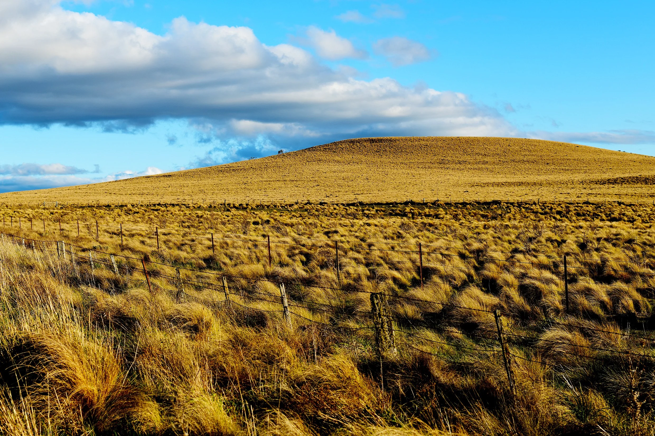
Poa Tussock Grasslands on the Monaro at One Tree Hill (Photo Dr. Dennis Williamson © 2024)


What We Need for Effective Visual Impact Assessment of Australian Landscapes

Maria Island from Triabunna, Tasmania (Source: Dennis Williamson, Copyright ©2016)

Maria Island from Triabunna, Tasmania (Source: Dennis Williamson, Copyright ©2016)

By Dr. Dennis N. Williamson

This article provides a brief discussion of and suggestions regarding visual resource assessment and visual impact assessment of Australian Landscapes. References are provided at the end for the Author’s article. 

Copyright © 2018 by Dennis N. Williamson and Geoscene International (a division of Scenic Spectrums Pty Ltd). All rights reserved - see end of article for re-use arrangements.

Brief Background

In Australia and many other countries around the world, the formalised practice of visual (or scenic) resource assessment and visual impact assessment of landscapes has been around since the early 1970s, perhaps longer if we look at some of the early work of people like Dame Sylvia Crowe, Burton Litton, Donald Appleyard, Kevin Lynch and others. 

The U.S. Forest Service’s Visual Management System (VMS)[1] is one of the world’s first truly systematic procedures applied extensively at landscape scales to National Forest lands across the United States during the early 1970s. A series of National Forest Landscape Management hand-books, including Litton’s work on forest landscape description and basic terminology, the VMS procedure (in what some referred to as the ‘big eye’ book – see Figure 1), and a number of other volumes that addressed specific visual management issues related to timber harvests, roads, and utilities. The VMS concept was logical and relatively straight-forward, fitting in as part of the overall multiple-use planning process with other forest resources. I was fortunate to be in on the ground floor of this visual resource management movement as a young Geographer working for Lolo National Forest in Montana.

Figure 1   The U.S. Forest Service Landscape Management Series and Visual Management System Procedure - 1974

(Source: Forest Service, 1974. National Forest Landscape Management Volume 2: Chapter 1 – The Visual Management System. U.S. Department of Agriculture, Washington D.C., U.S.A., cover and p. 9)

(Source: Forest Service, 1974. National Forest Landscape Management Volume 2: Chapter 1 – The Visual Management System. U.S. Department of Agriculture, Washington D.C., U.S.A., cover and p. 9)

During 1977, two U.S. Forest Service Landscape Architects (Richard Hammond and Ken Keefe) and I arrived Australia to adapt the U.S. VMS to approximately 6 million hectares of Victoria’s State Forests. The basic approach of the Victorian VMS remained much the same, as documented by Williamson and Calder [2].

However, new Landscape Character Types were described and delineated for the whole of Victoria and the terminology of the visual quality objectives was changed, using the concept of visual evidence or dominance to determine management targets. The resulting visual objectives for landscape change or alteration were ‘Inevident’, ‘Apparent’ (but not 'Dominant’) and ‘Dominant’ alterations. 

As an added verification and improvement to Victoria’s VMS scenic quality assessment criteria, we conducted scenic perception research[3] on 56 representative landscape scenes of forest, pine plantation and agricultural landscapes in the Ovens Valley and Mount Buffalo area of northeast Victoria. Photographs of these scenes were rated on a 7-point Likert scale (very high to very low scenic quality) by 348 observers, representing the community and different interest and age groups.  A series of physical and abstract landscape dimensions were measured as percentages or areas of each test scene. These were correlated statistically against the mean scenic quality rating of each scene, based on the mean Likert (Q-sort) scores of study participants overall (see Figure 2).

Figure 2   Scenic Perception Research for the former Forests Commission Victoria[4]

(Source: Dennis Williamson, Copyright ©1979)

(Source: Dennis Williamson, Copyright ©1979)

The research results showed a high positive correlation between scenes rated highly for their scenic quality and the presence of such landscape features and characteristics as naturalism, eucalypt forest cover, rock outcrops, and maximum distance seen. Scenic quality ratings tended to decrease for scenes with a greater presence of features such as pine forest, logged areas, flat slopes, brown agricultural fields, and buildings and structures. Eucalypt forest, rock outcrops, total tree cover, alpine grasslands and water explained over 76% of the variance in perceived scenic quality at a 99.5% confidence level. 

These research results compared favourably with an earlier Massachusetts study of a similar nature conducted by Zube, Pitt and Anderson[5]. Subsequent landscape and scenic perception research studies by such researchers as Dr. Ray Green[6], Jack Nasar[7], Stephen and Rachel Kaplan’s[8], Phillips et. al.[9] and others have generally had similar findings, particularly underscoring the importance of naturalness, rugged terrain, green-ness and waterforms as positive influences on people’s perceptions of and ratings of landscape scenic quality. During 2005, a scenic perception study of the South East Queensland region was also carried out[10].

Through 1985 (with the assistance of Stuart Calder and Michael Leonard of the FCV) we transferred our VMS knowledge widely throughout the southern Australian States through training workshops, university lectures, field days, journal articles and conferences. Foresters and engineers from various government departments were trained. We also trained a team of young Australian graduate Landscape Architects (including Steve Moss, Scott Murray and Michael Sandford) to take our place when we vacated our positions. VMS awareness and support was high among the professional and general community.

The Victorian VMS procedure provided the basis for the Visual Management Systems developed by the Tasmanian Forestry Commission and that by the Western Australian Department of Conservation and Land Management (CALM) during the 1980s – both of which have since been updated.[11] The U.S. Forest Service VMS was also updated during 1995[12], introducing the components of ecological unit description, scenic integrity and alternative development evaluation.

Various other visual assessment procedures were developed and trialed in other Australian States by university researchers and government departments, but systematic procedures do not appear to have been adopted by State Governments for widespread use during the 1980s and early 1990s. A more thorough examination of this history is required with the assistance of those who have been actively involved in the various States concerned.

During 1989 and 1992, I developed and applied my adaptation of the Victorian VMS to the Wet Tropics of Queensland World Heritage Area for its nomination assessment and for the first management plan following the area's inscription by the World Heritage Committee[13]. World Heritage assessments under criteria (vii) of the World Heritage Operational Guidelines[14] require the establishment of justification for Outstanding Universal Value (OUV) being evident in properties that “contain superlative natural phenomena or areas of exceptional natural beauty and aesthetic importance”. However, the World Heritage Committee have provided little in the way of specific guidance or procedures for assessing the two separate aspects of criteria (vii) – natural phenomena and natural beauty.

For the Wet Tropics and other inscribed World Heritage Areas in China, Tasmania, and Western Australia, I developed new procedures and criteria. (Such criteria may again be useful as the Tasmanian Government seeks to commercialise the Tasmanian Wilderness WHA at Frenchmans Cap and elsewhere.) Since 2010-11, minor additional guidance was offered through the document Preparing World Heritage Nominations[15], however, not enough. Since that time, Mitchell[16] has reviewed the assessment of this World Heritage criteria, providing some useful recommendations for a more systematic application of criterion (vii). However, there remains more work to be done and some form of global consensus to be achieved.

A Plethora of Visual Assessment Procedures Since the Late 1990s

I have played a strong role in promoting the use of visual assessment in the context of private and public lands, rural and urban, in Australia since establishing Scenic Spectrums as a consultancy during 1985.  There is no doubt that there has been a distinct increase in the number of visual resource assessments since the mid-1990s, particularly in relation to visual impact assessments. This has been stimulated by a range of environmental protection laws and regulations at the Federal and State government levels and by the upsurge of large scale mining projects and infrastructure development for roads, ports, energy, tourism, urban development and other types of alteration.

Government agencies responsible for the planning approvals for such developments have by enlarge accepted and required some form of visual impact assessment in the approvals process for such facilities. This also reflects the general demand by the Australian public who have shown a great deal of concern regarding landscape and scenic values.

Not surprisingly, a wide array of landscape and engineering consultants have seen the commercial opportunity and provided services in visual impact assessment. And this has resulted in a plethora of different visual assessment procedures and criteria being applied across Australia - some good and some not so good. In the process, the VMS methodology that was adapted for application in Victoria, Tasmania and Western Australia has largely been lost through the cavalcade of changes in governments and government departments.

For the most part, Landscape Architects have been seen as the professionals best qualified to make such assessments. Ironically, I am unaware of any Australian university Landscape Architecture or design programs that include a comprehensive subject on visual resource assessment. Most LA graduates would not have any knowledge of the basic concepts, terminology and methodologies for visual assessment when they enter the workforce. Even though Landscape Architects are fast learners and innovative, I have seen some very inadequate visual impact assessments conducted over the years.

The LVIA Approach

Since the early 2000s, reduced teaching and promotion of the VMS approach has led to an alternative method from the United Kingdom, the Landscape and Visual Impact Assessment (LVIA) approach, being fairly widely adapted and applied in Australia. The third edition of this procedure, known as GLIVA3[17], has been referred to since 2013.  The LVIA approach has the same basic intentions as the VMS and includes some of the same aspects relation to the identification of landscape character. Good points also include its attempt at presenting a high-level framework for integrating visual impact assessment into the broader environmental impact assessment process in the UK and offering guidance on the assessment of cumulative visual impacts, the duration of impacts and mitigation of impacts. The latest U.S. Forest Service procedure and my adaption (Scenic Spectrums' Visual Evaluation Method) also include these considerations.

The LVIA approach also has several critical flaws, including:

  • It is a ‘word heavy’ document with a complicated series flow charts used to provide an overview of the process – it is not simple and straight-forward;

  • In trying to avoid providing strict criteria or a ‘recipe’ approach, it lacks specifically useful criteria, methods and examples for assessing visual landscape or scenic quality, visual significance and degrees of visual impact;

  • It relies on what I believe is a ‘black box’ approach for the assessment of both scenic significance and visual impact assessment, combining assessments of the sensitivity, value and importance of the ‘receptor’ and matching them against the combined assessments of the magnitude, probability and reversibility of the impact (or ‘nature of effect’) using a matrix of sliding scales (i.e., high to negligible) on each axis and warped gradient lines for assigning the degree of significance (i.e., very substantial to not significant) according to UK EIA standards that are not transparent to the community or to planning decision-makers;

  • It does not utilise the concept of or provide a defined set of viewing distance zones appropriate to most situations. It relies too greatly on computerised mapping of the ‘Zone of Theoretical Visibility’ without providing enough consideration of the visual screening effects of trees and buildings;

  • It attempts to make a distinction between ‘landscape’ baseline assessment and effects and ‘visual’ baseline assessment and effects, which becomes overly complicated and confusing;

  • It does not advocate the need for or benefits of visual or scenic perception research or surveys, relying on professional judgement;

  • It uses ambiguous, repetitive and sometimes obtuse or mechanical terminology (e.g., ‘landscape receptors’ - meaning landscape features and ‘visual receptors’ - meaning people);

  • It provides no specific framework for identifying desired visual quality objectives or visual performance standards to serve as benchmarks against with proposed landscape alterations can be measured or compared; and

  • It leaves decisions regarding the scope of the assessments and the criteria for making the various assessments open to negotiation between the Landscape Architect or assessor and the relevant government authority, with ‘no hard & fast rules’, leaving the procedure and criteria subject to change from one project to another.

I have been engaged to peer review a few LVIA assessments and to occasionally apply the process on behalf of clients. I have often found that the reviewed assessment or requested procedure has applied the LVIA method in a non-rigorous and subjective manner, is missing key factors for consideration (such as identifying viewpoints in one example), or is lacking in transparency and clear justification for the assessments made. On one occasion, the Peer Review process itself was abused by the proponent client.

Government Authorities and Decision-Makers Lacking Basic Concepts and Understanding

The added problem with visual impact assessment is that most of the Australian government authorities, planning review panels, planning appeals bodies and environment courts have not set out basic requirements for visual impact assessments. Some exceptions to this include the visual landscape planning manual prepared by the Western Australian Planning Commission and the WA Department for Planning and Infrastructure[18] and the recent NSW Wind Energy: Visual Assessment Bulletin[19]. Many, if not most, of the government employees and planning approval adjudicators have not had any basic training regarding visual assessment concepts, terminology and methodology.

The Basics of What We Need in Australia for Effective Visual Impact Assessments

Given the current circumstances, it is no wonder that we have trouble reaching agreement between different ‘visual assessment experts’ and among the planning decision-makers regarding what constitutes an area of high or lesser scenic quality or visual significance, and whether a proposed development will create a significant visual impact or not, as well as agreeing on what to do about that. In addition, we completely lack any consistency in visual assessment procedures and terminology from one Australian State to another.

Although we can go into the comparative effectiveness of the different procedures another time, all these different visual assessment procedures should have the same basic aims:

  • to determine the relative visual or scenic importance of landscapes; and

  • to assess the degree to which various alterations may impact on those landscapes.

This is done to provide a reference to compare landscape values to other social and resource utilisation values so that decisions can be made based on a comprehensive and objective assessment.

Regardless of what visual assessment procedure is used, it needs to provide a thorough and adequate understanding and assessment of five key pieces of information:

  • The features and magnitude of the proposed development in terms of its location, relative size, built form, component parts, dimensions, colours, artificial lighting effects, movable objects (e.g., cars, gondolas, ships) and the frequency of their movement, and other factors;

  • The existing visual condition and scenic quality of the relevant landscape or seascape in terms of the configuration, landscape character, natural and cultural features of the landscape and seascape surrounding the proposed development, including key viewpoints and their relative public sensitivity levels, viewing distances and the significance of landscape zones affected by the proposed development;

  • The desired future character and quality of the landscape/seascape in terms of specific visual performance standards for the area;

  • What the proposed development may look like within the context of the existing landscape/seascape from the key viewpoints, how that may affect the future appearance and visual quality of the landscape/seascape as compared to the visual performance standards, and how any forms of mitigation may result in visual impact reduction of undesirable visual effects (utilising photographs, sketches, computer simulations and photomontages as appropriate); and

  • The acceptability or non-acceptability by the community of proposed visual alterations in relation to agreed visual performance standards used to assess potential visual impacts to the existing landscape and its visual or scenic qualities (where possible, in terms of the scenic perception responses of key stakeholders).

Landscape and visual assessment is an inherently complex field of analysis and assessment, but we don’t need to make it any more complex than is necessary. As much as possible, a straight-forward approach in which everyone understands the terminology, methodology and criteria should be used.

Reaching consensus on visual assessment methods and criteria is no doubt difficult, as is reflected in the wide range of procedures that have been formulated over the past 50 years. Perhaps the lack of detailed and transparent criteria reflected in the LVIA is also due to an inability to reach consensus on the details of such a procedure. However, I think that Australian landscape and environmental planners, designers and decision-makers need to do themselves and the wider community a favour by resolving this issue more appropriately for future application.

We need to get heads together from all States and the relevant arenas to provide the following actions and outcomes:

1.       Consensus and agreement on the basic concepts and terminology of visual assessment/visual impact assessment as possible;

2.       The funding and implementation of appropriate visual/scenic perception research studies in relation to key visual/scenic quality issues and landscape alteration types and magnitude;

3.       Consensus and agreement as far as possible on a standard procedure or at least standard elements of a procedure with as much detail on assessment criteria and methods as possible (with potential variations for assessing the visual impact of specific types of alterations, such as roads, wind farms, solar farms; roads and other transport modes, etc. and for different basic landscape character contexts);

4.       Provision of comprehensive and effective awareness-raising, education and training courses and workshops for visual assessment within the appropriate university planning and design programs, within the relevant government departments, within the field of visual assessment consultants and the relevant professional associations (e.g., AILA, EIANZ, VEPLA, etc.), and within the relevant statutory planning review panels and courts. This training should include the basic concepts, terminology, visual perception research, capabilities of the human eye, assessment methodologies, analysis technologies (e.g., GIS mapping, use of viewline cross-sections, computer simulations and photomontages, etc.), and (importantly) the ethics of expert assessors in their duty to represent the landscape as a valuable community and ecological resource in an objective and factual manner.

Although not suggesting that other approaches cannot be valid, I believe that the thrust of a VMS methodology is much more understandable and effective than the LVIA approach that currently dominates visual assessment in Australia. I have continued to use the basics of the VMS approach as effective in addressing all of the above key assessment elements, but I have made changes and improvements to it for wider application with my Scenic Spectrums Visual Evaluation Model (SS-VEM), as shown in Figure 3.

Figure 3           Scenic Spectrums’ Visual Evaluation Model (SS-VEM)

(Source: Scenic Spectrums Pty Ltd, 2005. Scenic Spectrums’ Visual Evaluation Model (SS-VEM). Copyright © 2005 by Scenic Spectrums Pty Ltd and Dennis N. Williamson. All rights reserved.) 

(Source: Scenic Spectrums Pty Ltd, 2005. Scenic Spectrums’ Visual Evaluation Model (SS-VEM). Copyright © 2005 by Scenic Spectrums Pty Ltd and Dennis N. Williamson. All rights reserved.) 

However, the LVIA process could likewise be improved if that is the general approach more people prefer. In my recent work with the NSW Department of Planning and Environment on their wind energy visual assessment, they desired to use a Rapid Visual Impact Assessment procedure with a reduced number of assessment factors to inform preliminary discussions with wind farm proponents and the community prior to developing terms of reference for a full visual assessment of projects of State significance. A preliminary illustration of such a process is shown in Figure 4.

Figure 4    A Potential Rapid Visual Impact Assessment (RVIA) and Full Visual Impact Assessment (FVIA) Approach

(Source: Scenic Spectrums Pty Ltd, 2016. A Potential Rapid Visual Impact Assessment (RVIA) and Full Visual Impact Assessment (FVIA) Approach. Copyright © 2016 by Scenic Spectrums Pty Ltd and Dennis N. Williamson. All rights reserved.)

(Source: Scenic Spectrums Pty Ltd, 2016. A Potential Rapid Visual Impact Assessment (RVIA) and Full Visual Impact Assessment (FVIA) Approach. Copyright © 2016 by Scenic Spectrums Pty Ltd and Dennis N. Williamson. All rights reserved.)

The above suggested review and revision process may take a while to initiate. I am hopeful, but a realist - it may not occur at all. Even if it does, there is no guarantee that consensus and an agreed path forward will emerge. So, for any government agencies or even private consulting firms that are currently experiencing difficulties with the application of your visual impact assessment procedures, I would urge you to conduct your own review and revisions in the interim to ensure you have an effective and operable visual assessment procedure and criteria to serve the needs of your own organisation until something better is established.

References

[1]     Forest Service, 1974. National Forest Landscape Management Volume 2: Chapter 1 – The Visual Management System. U.S. Department of Agriculture, Washington D.C., U.S.A, 47 pp.

[2]     Williamson, Dennis and Calder, Stuart, 1979. “Visual Resource Management of Victoria’s Forests: A New Concept for Australia” in Landscape Planning, Vol. 6, pp 313-341.

[3]     Williamson, Dennis N and Chalmers, John A, 1982.  Perceptions of Forest Scenic Quality in Northeast Victoria: A Technical Report of Research Phases I and II.  Landscape Management Series. Melbourne, Victoria: Forests Commission Victoria, p. 99.

[4]     Williamson and Chalmers, 1982. ibid.

[5]     Zube, Ervin H & Pitt, David G, & Anderson, TW, 1974. Perception and measurement of scenic resources in the Southern Connecticut River Valley. Institute for Man and His Environment, University of Massachusetts, Amherst.

[6]     Green, Ray, 2000. “Scenic and Town Character Assessment: A Methodology for Community Involvement” in Australian Planner Vol. 37 (1).

[7]     Nasar, Jack, 2001.  “Images of Cities” in NJ Smelser and PB Baltes (Eds.), International Encyclopedia of the Social Behavioural Sciences. Elsevier Science Ltd. Oxford: Pergamon, pp. 1822-1825.

[8]     Kaplan, R and Kaplan, S, 1989. The Experience of Nature: A Psychological Perspective. Cambridge, Massachusetts: Cambridge University Press, 340 pp.

[9]     Phillips, MR, Edwards, AM and Williams, AT, 2010. “An incremental scenic assessment of the Glamorgan Heritage Coast, UK” in The Geographical Journal, Vol. 176, No. 4, December 2010, pp. 291–303, doi: 10.1111/j.1475-4959.2010. 00361.x.

[10]    SEQ Regional Scenic Amenity Study, 2005. What's in a view? Report 1: Overview of the Scenic SEQ 2004 Public Preference Survey, Brisbane.

[11]    Refer to:

  • Forest Practices Authority, 2016. A Manual for Forest Landscape Management. Republished by the Forest Practice Authority, Tasmania — 24-10-2006 from the former Forestry Commission Tasmania, 1990. Government of Tasmania, Hobart, Tasmania, 194 pp.

  • Department of Conservation and Land Management, 1989. Visual Resource Management on Lands and Waters Managed by CALM. Policy Statement No. 34, Stage of Western Australia, Perth, 4 pp.

  • Western Australian Planning Commission and Department for Planning and Infrastructure, 2007. Visual Landscape Planning in Western Australia: a manual for evaluation, assessment, siting and design. State of Western Australia, Perth, 188 pp.

  • [12]    Forest Service, 1995. Landscape Aesthetics: A Handbook for Scenery Management. Agriculture Handbook Number 701. United States Department of Agriculture.

[13]    Refer to:

  • Williamson, Dennis, 1989. An Evaluation of Scenic Quality and Landscape Alterations in Wet Tropical Rainforest and Associated Landscapes of North-East Queensland in Relation to World Heritage Standards prepared for The State Government of Queensland by Scenic Spectrums Pty. Ltd.

  • Williamson, Dennis, 1992. Scenic Resource Evaluation of the Wet Tropics World Heritage Area – Wet Tropics Plan: Strategic Directions for the Wet Tropics Management Agency by Scenic Spectrums Pty. Ltd. in association with ESRI Australia Pty. Ltd.

[14]    Intergovernmental Committee for the Protection of the World Cultural and Natural Heritage, 2016. Operational Guidelines for the Implementation of the World Heritage Convention. United Nations Educational, Scientific and Cultural Organisation (UNESCO), World Heritage Centre. Paris, France, 175 pp.

[15]    Marshall, D, UNESCO, The World Conservation Union (IUCN), International Council on Monuments and Sites (ICOMOS), & International Centre for the Study of the Preservation and the Restoration of Cultural Property (ICCROM), and Centre International d'Études pour la Conservation et la Restauration des Biens Culturels (ICCROM), 2011. Preparing World Heritage nominations (2nd ed.). Paris: UNESCO, 136 pp.

[16]    Mitchell, N, with contributions from Leitão, L, Migon, P and Denyer, S, 2013. Study on the Application of Criterion (vii): Considering superlative natural phenomena and exceptional natural beauty within the World Heritage Convention. Gland, Switzerland: IUCN. 112 pp.

[17]    Landscape Institute and Institute of Environmental Management & Assessment, 2013. Guidelines for landscape and visual impact assessment. Routledge, Abingdon, UK, 169 pp.

[18]    Western Australian Planning Commission and Department for Planning and Infrastructure, 2007. Visual Landscape Planning in Western Australia: a manual for evaluation, assessment, siting and design. State of Western Australia, Perth, 188 pp.

[19]    Department of Planning and Environment, 2016. Wind Energy Visual Assessment Bulletin: For State significant wind energy development. NSW State Government, Sydney, NSW, 44 pp.

Copyright © 2018 by Dennis N. Williamson and Geoscene International (a division of Scenic Spectrums Pty Ltd). Unauthorized use and/or duplication of this material without express and written permission from this site’s author and/or owner is strictly prohibited. Excerpts and links may be used, provided that full and clear credit is given to Dr. Dennis N. Williamson and Geoscene International (a division of Scenic Spectrums Pty Ltd) with appropriate and specific direction to the original content.

AUSTRALIAN HABITAT FRAGMENTATION – SPECIES LOSS IN A CLIMATE OF CHANGE

AUSTRALIAN HABITAT FRAGMENTATION –  SPECIES LOSS IN A CLIMATE OF CHANGE

In recent times a great deal of concern has been expressed that we are in danger of losing a high percentage of Australian native plant and animal species due to the combined effects of habitat fragmentation, climate change and other factors. There have been outcries for and against changes in legislation that make it easier for private landholders to clear remnant native vegetation. However, many of the arguments put forward in newspaper and magazine articles do not always provide the full context of the history of species loss in Australia or the underlying reasons as to why such species and ecosystems are so fragile and precariously balanced at this point in time. My blog article focuses on the historical background, the interplay of native vegetation clearing and climate change, and the implications of these threats not only on native species, but on agricultural productivity and on the character and identity of Australia.